Geospatial Analysis
Effective geospatial data management and analysis underpins the geoscience services provided to our clients, with studies ranging from regional scale early market assessments to detailed site-based concept and routing designs. Our work is specifically designed to maximize the value of existing data alongside new surveys within targeted geospatial assessments, which aid strategic decision-making and help resolve your engineering challenges.

Market Challenges
Geospatial analysis plays a critical role in addressing a number of common challenges in offshore wind development and other large-scale renewable energy infrastructure projects. These challenges include, but are not limited to:
Site selection.
Environmental Impact Assessment (EIA) and regulatory compliance.
Subsea terrain and seabed conditions.
Geohazard identification.
Marine and coastal dynamics and climate change impact.
Multi-use and stakeholder conflicts.
Infrastructure planning.
Our Solutions
Geospatial analysis is the preparation of statistical and analytical models to quantify the interaction of infrastructure with the ground.
OWC’s geospatial analysis services:
- Geospatial data management
- Geospatial constraint and opportunity analysis for early market studies
- Geospatial services for detailed planning and design
- Geospatial application and tool development (python)
- Geospatial web mapping
- Slope stability analysis
Geospatial data management
We are experienced in acquiring, reviewing, managing and analysing a wide range of geospatial data to support any given project, covering both open-source data, data from structured geodatabases, and commercial geospatial data. Our service offering includes developing geospatial metadata and registers of geospatial data sources. We are able to supply and present complex geospatial data within structured geodatabases to support a client’s objectives or project.
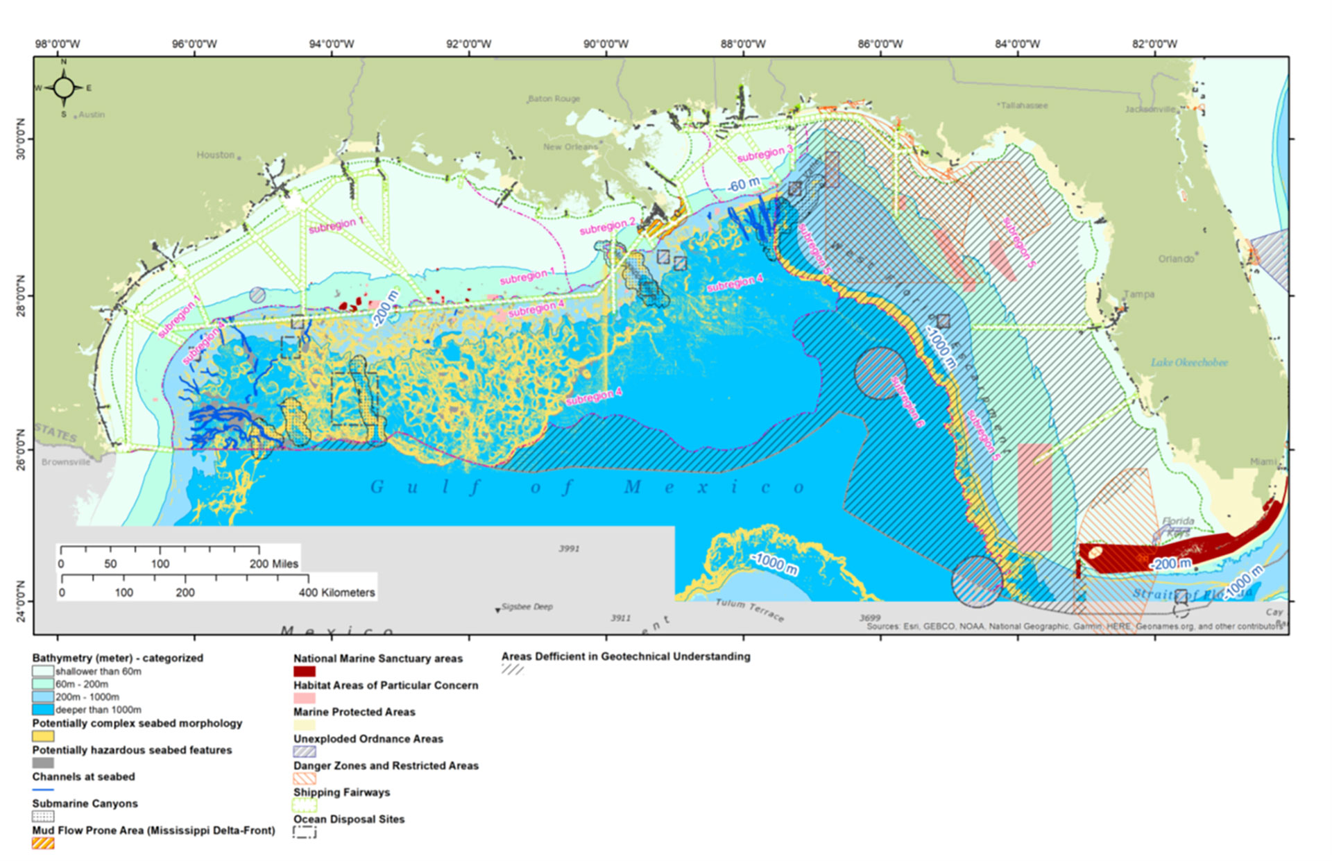
Geospatial constraint and opportunity analysis in early market studies
This service is closely aligned with our geospatial data management service. It covers a number of deliverables:
- Technical, cost, environmental and human opportunity constraint layers development
- Geospatial suitability models for site ranking and selection
- Production of graphical figures and statistical data
- Geospatial market-focused reports, incl. GIS-based q figures and statistics
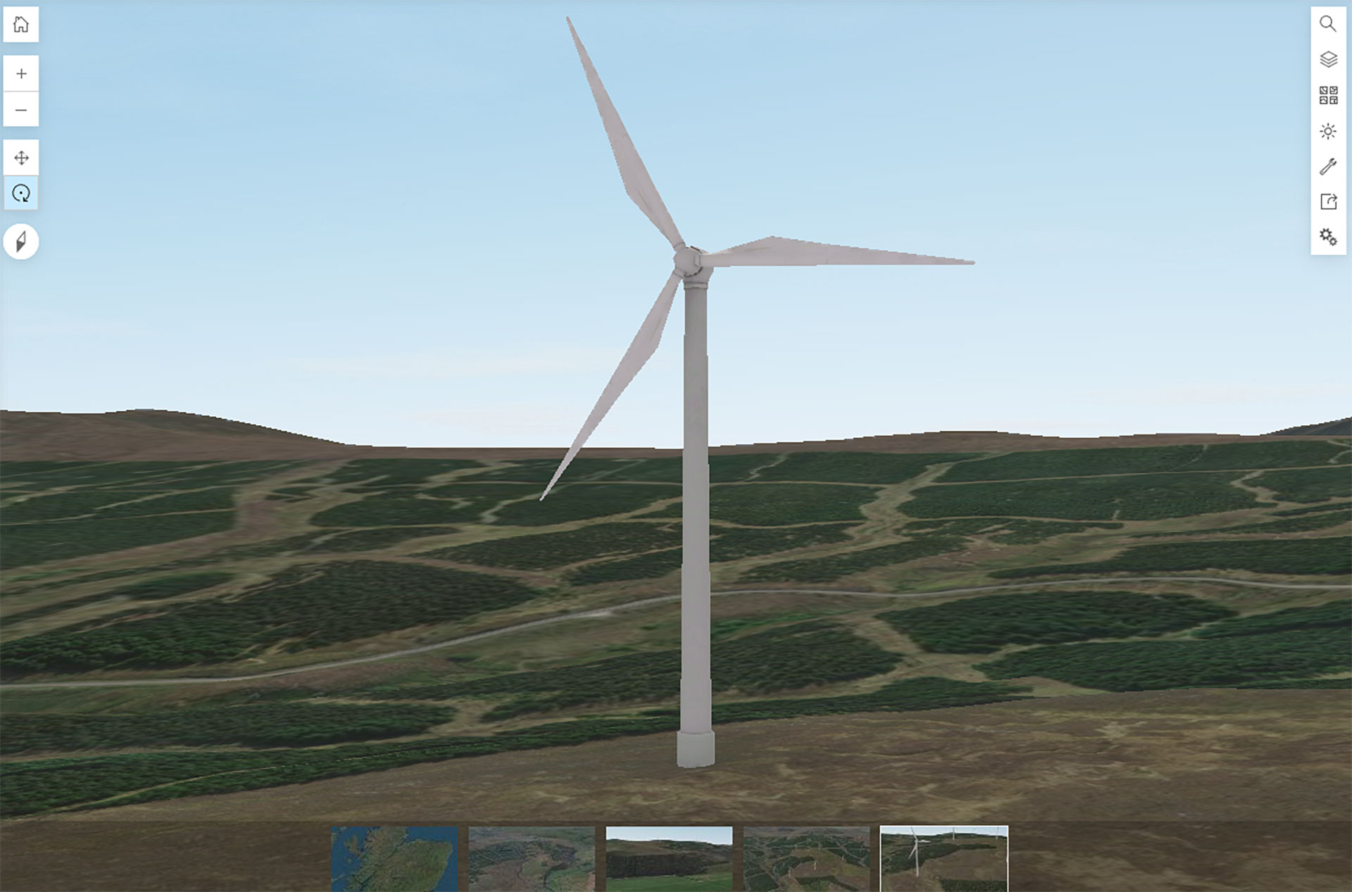
Geospatial for detailed planning and design
We are experienced in producing graphical reproductions of detailed project and survey data covering ground conditions, environmental issues, and other existing infrastructure in an area, such as cables, pipelines, and UXOs. Our service aims to visualise and clearly communicate the spatial interactions between the project or asset under development and surrounding constraints. It therefore, provides critical deliverables to support greater accuracy in planning and design for the long-term sustainability of an asset.
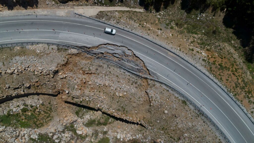
Slope Stability Analysis
Landslides pose a major hazard onshore and offshore to engineering projects. We perform GIS-based slope stability screening, slope modelling and numerical landslide runout analysis. Our work, in conjunction with BP and Professor Alexander Puzrin of ETH Zurich culminated in award of the David Hislop Prize 2018 from the Institute of Civil Engineers.
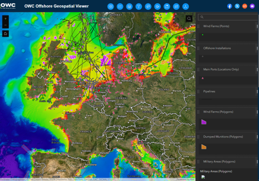
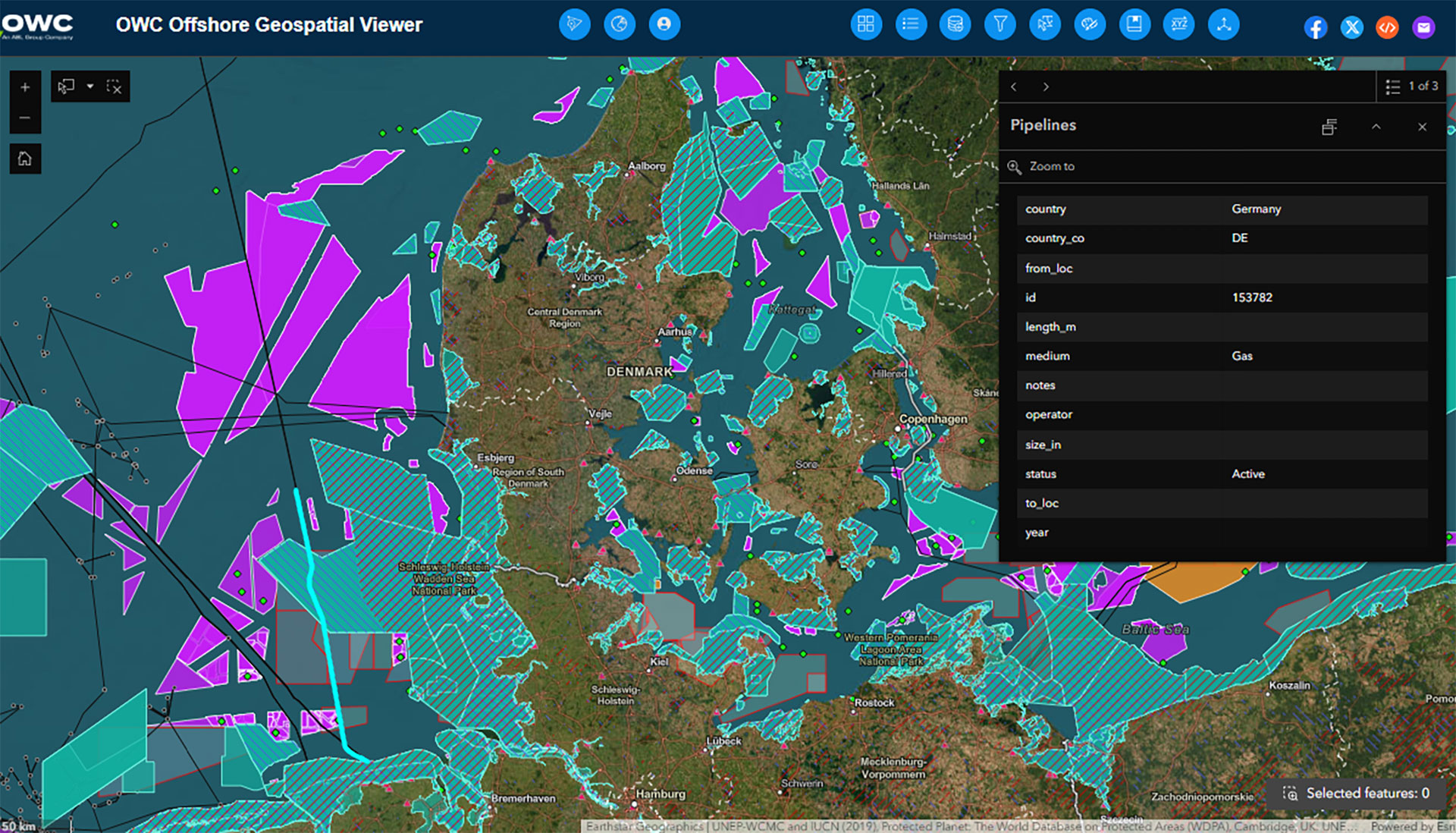
Geospatial web mapping
Our geospatial web mapping involves the development and maintenance of secure web mapping portal sites, including tools for queries, analysis, and reporting. By providing the client with secure 24/7 access to core project data, this service contributed to the overall delivery of a safe and healthy work environment and single source of truth to support operational and strategic decisions.
Our interpretations are targeted and efficient and use industry-standard software, including ArcGIS Pro and QGIS.
OWC initially builds ground models by performing regional geological assessments and desk studies using publicly available data. Ground models are iterated to incorporate factual and interpretive geo-data, which include morphological, geophysical and geotechnical datasets.
We work extremely closely with the client, forming a single team, and can tailor work scopes to meet the project’s needs. This improves communication and alignment between OWC and the client, saving time and cost.
Additionally, we are highly adaptable and accustomed to a client’s changing needs as a project progresses and scopes naturally evolve. We continuously reevaluate our role and the client’s needs to overcome unforeseen challenges or changes in scope as smoothly as possible.
The value we bring
In-house and global geospatial discipline.
Deep-rooted experience in onshore and offshore wind projects.
Diverse project track-record.
Questions? Get in touch
Related Services
Technical Studies
Geoscience
Fixed & Floating Foundation Engineering & Design
Related News & Media
Meet the Team: Minjy Lee, PhD, Junior Geotechnical Engineer | OWC South Korea

OWC signs Vietnam wind cooperation

Meet the Team: Dat Dang, Renewable Energy Engineer | OWC Vietnam
Meet the team: Nguyen Dinh | OWC Vietnam
OWC and Time for Geography recognised for contributions to geoscience education